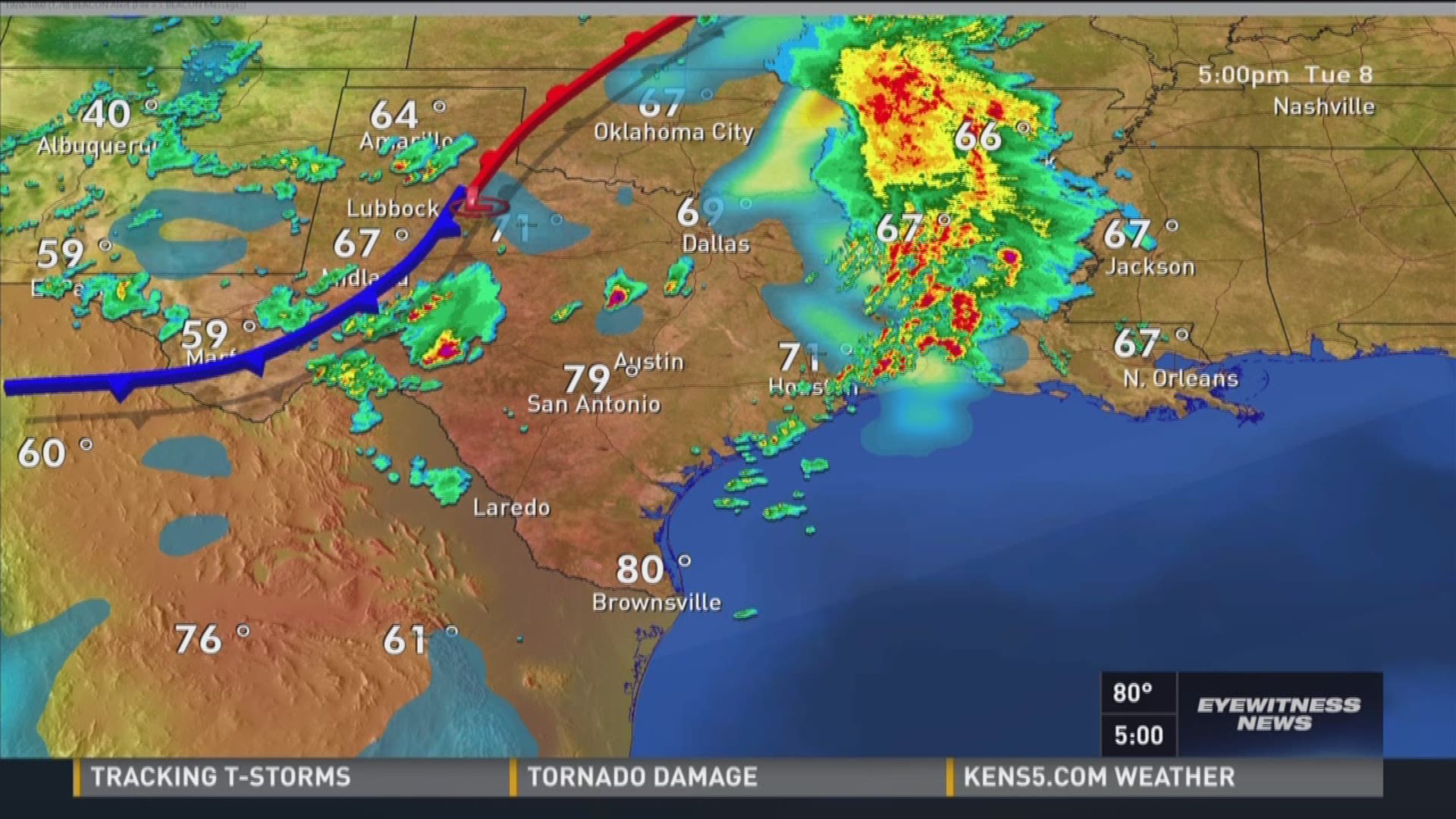
Doppler radar is a specialized tracking system that uses the Doppler effect to measure the velocity and direction of moving objects, such as precipitation particles or aircraft, relative to the radar site. By transmitting microwave pulses and analyzing the frequency shift of the returned echoes, it provides meteorologists and aviation controllers with real-time velocity data essential for severe weather detection and air traffic management.
Understanding the Physics Behind Doppler Radar
At its core, a Doppler radar system operates on the fundamental principles of electromagnetism and wave mechanics. Understanding how it functions requires examining both the generation of radio frequency energy and the interpretation of returned signals.
The Doppler Effect Explained
The Doppler effect describes the change in frequency or wavelength of a wave in relation to an observer who is moving relative to the wave source. In the context of radar, the antenna acts as both the source and the stationary observer.
When a pulse of microwave energy strikes a moving target—such as a raindrop, snowflake, or piece of debris—the energy is scattered in all directions. A portion of that scattered energy returns to the radar antenna. If the target is moving toward the radar, the returning wave is compressed, resulting in a higher frequency. Conversely, if the target is moving away, the wave is stretched, yielding a lower frequency.
Frequency Shift and Phase Change
Radars do not measure frequency directly on a single pulse; instead, they measure the phase change of consecutive pulses returning from the same target volume. This phase difference, known as the pulse-pair spacing, allows processors to calculate the exact radial velocity—the speed of the target either directly toward or directly away from the radar site.
Mathematically, the Doppler frequency shift ($f_d$) is proportional to the target's velocity ($v$) and the wavelength ($\lambda$) of the transmitted signal, expressed as:
$$f_d = \frac{2v}{\lambda}$$
Because the radar only measures motion along the beam axis, it captures only the radial component of a target's true three-dimensional velocity. Meteorologists use networks of multiple radars to resolve these radial velocities into complete vector wind fields.
Core Components of a Doppler Radar System
A functional Doppler radar installation consists of several highly specialized hardware subsystems working in synchronization.
- Transmitter: Generates high-power bursts of microwave energy. Modern systems often use klystrons or magnetrons, though newer solid-state transmitters are increasingly common for enhanced reliability.
- Antenna: Typically a large parabolic dish housed inside a protective spherical dome called a radome. The radome shields the sensitive machinery from high winds, ice, and solar heating while allowing microwave signals to pass through with minimal attenuation.
- Receiver: Detects the extremely weak radio frequency signals returned from atmospheric targets and amplifies them for processing.
- Signal Processor: Employs complex algorithms, including fast Fourier transforms (FFTs), to separate meteorological echoes from ground clutter and calculate reflectivity, velocity, and spectrum width.
Primary Applications of Doppler Radar
While initially developed for military tracking during World War II, Doppler radar has become an indispensable tool across several civilian and scientific domains.
Meteorological Forecasting and Severe Weather Warning
In meteorology, Doppler radar systems—such as the United States' WSR-88D (Weather Surveillance Radar-1988 Doppler) network operated by the National Weather Service—form the backbone of severe storm monitoring.
- Tornado Detection: By identifying tight, contrasting patterns of inbound and outbound winds (known as a mesocyclone signature or tornadic vortex signature), meteorologists can issue tornado warnings before visual confirmation occurs on the ground.
- Wind Shear and Microbursts: Aviation meteorology relies on terminal Doppler weather radar to detect sudden, hazardous changes in wind speed and direction near airports, preventing catastrophic aircraft accidents during takeoff and landing.
- Precipitation Measurement: By analyzing the intensity of the returned signal (reflectivity) alongside velocity, forecasters can estimate rainfall rates, snowfall accumulations, and hail sizes over vast geographic areas.
Air Traffic Control and Aviation
Air traffic surveillance relies heavily on primary and secondary radar, but Doppler processing is integrated into modern airport surveillance radar (ASR) systems. It helps air traffic controllers filter out stationary ground clutter (such as buildings and terrain) and moving precipitation, ensuring that aircraft targets remain visible during heavy rainstorms or snow events.
Military and Defense Tracking
Defense applications utilize high-frequency Doppler radar for target acquisition, missile defense, and tracking fast-moving projectiles or aircraft. Ground-moving target indication (GMTI) algorithms exploit the Doppler shift to distinguish vehicles driving across terrain from stationary trees and rocks.
Comparison of Radar Technologies
To understand the specific advantages of Doppler radar, it helps to compare it against older or alternative remote sensing methods.
| Radar Type | Primary Capability | Key Advantage | Limitation |
|---|---|---|---|
| Conventional Non-Doppler Radar | Measures location and intensity (reflectivity). | Simpler hardware design; effective for basic mapping. | Cannot measure target velocity or wind direction. |
| Doppler Radar | Measures location, intensity, and radial velocity. | Detects rotation, wind shear, and severe storm structures. | Blind to motion perpendicular to the radar beam (cone of silence). |
| Dual-Polarization Radar | Transmits horizontal and vertical pulses simultaneously. | Identifies precipitation type (rain, hail, snow) and debris. | Requires more complex calibration and data processing. |
Operational Limitations and Challenges
Despite its remarkable utility, Doppler radar is subject to several physical and technical constraints that operators must account for.
The Cone of Silence and Beam Broadening
As a radar beam travels outward from the antenna, it expands in width and rises in altitude due to the curvature of the Earth. This creates a conical area directly above the radar site where targets cannot be adequately sampled—a phenomenon known as the cone of silence. Furthermore, at long ranges, the broad beam samples a very large volume of air, which can average out small-scale atmospheric features.
Range-Velocity Ambiguity
A fundamental limitation in pulsed radar systems is the Doppler dilemma: maximizing the unambiguous range requires a low pulse repetition frequency (PRF), while measuring a wide range of high velocities requires a high PRF. Engineers use staggered PRFs and phase-coding techniques to mitigate this trade-off, but extreme weather events can still occasionally result in velocity aliasing (where high winds wrap around the color scale, appearing to move in the opposite direction).
Ground Clutter and Anomalous Propagation
Buildings, hills, and wind turbines reflect microwave energy strongly, creating permanent ground clutter echoes. Additionally, atmospheric temperature inversions can bend radar beams downward toward the ground—a condition called anomalous propagation—causing false precipitation echoes to appear on display screens. Modern systems use advanced digital filtering algorithms to remove these artifacts.
Frequently Asked Questions
How does Doppler radar detect a tornado?
Doppler radar detects tornadoes by measuring the radial velocity of precipitation particles rotating within a parent thunderstorm. When a storm exhibits a tight couplet of winds moving directly toward the radar adjacent to winds moving away from it, it indicates strong rotation (a mesocyclone), which often precedes or accompanies tornadic development.
What is the difference between standard radar and Doppler radar?
Standard non-Doppler radar only measures the position and reflectivity (intensity) of a target, showing where precipitation is located and how heavy it is. Doppler radar measures both reflectivity and the speed and direction of the target's movement relative to the radar site, allowing analysts to observe wind fields and internal storm dynamics.
Can Doppler radar see through all weather conditions?
No. While microwaves can penetrate light rain, fog, and snow, very heavy rainfall, hail, or dense thunderstorms can cause signal attenuation—meaning the radar beam is weakened as it passes through the storm, reducing its ability to detect features on the far side of the precipitation core.
Why do Doppler radar displays show different colors?
The colors on a Doppler radar velocity display represent the direction and speed of targets relative to the radar. Typically, cool colors (greens and blues) indicate winds or precipitation moving toward the radar, while warm colors (reds and yellows) indicate movement away from the radar. Bright, contrasting colors close together signal high wind shear.
Is Doppler radar data accessible to the public?
Yes. National meteorological agencies, such as the National Weather Service in the United States and the Bureau of Meteorology in Australia, provide real-time, high-resolution Doppler radar imagery to the public via government websites and mobile applications.
Practical Recommendations for Weather Monitoring
When relying on Doppler radar for severe weather preparedness, users should keep several best practices in mind:
- Understand the Beam Height: Remember that radar beams rise as they travel away from the site. A storm 100 miles away is being sampled thousands of feet up in the atmosphere, meaning low-level features like weak tornadoes may be missed.
- Combine Data Sources: Never rely solely on a single radar image. Cross-reference velocity data with satellite imagery, surface observations, and official warnings issued by meteorological authorities.
- Account for Latency: Real-time radar feeds typically involve a slight processing and transmission delay of several minutes. In fast-moving severe weather situations, account for this lag when tracking storm paths.